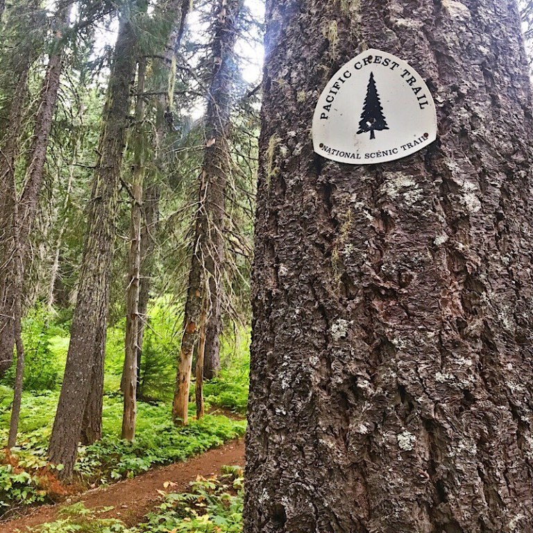
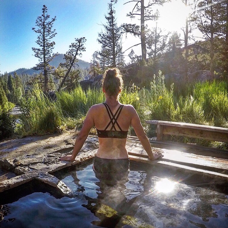
Hiking the PCT over the last four months has been an amazing experience. I’ve adapted to a whole new way of living life out here, learned a lot about myself, overcome numerous fears, developed friendships I’ll have for a lifetime and pushed myself mentally and physically beyond any limits I’ve ever put on myself before. The PCT has changed my life in ways I’d never imagined it could or would.
I’ve had numerous amazing experiences out here and I’ve had some not-so-amazing experiences. As with off-trail life, you have your good days and your bad days. On social media, it’s common for people to only talk about the good stuff they experience on the PCT – beautiful sunrises/sunsets, epic tentsites, the incredible views, other cool hikers, tasty food on trail/in town or trail magic along the way. But what about the not so good stuff?
When you hike 15-20+ miles a day for over four months, bad days are inevitable. When sharing my PCT thru-hiking experience, I think it’s important to talk about it all – the good, the bad and the really tough days. Since starting my PCT thru-hike back in April, three really tough days stand out as my absolute hardest out here so far.
Hard Day #1: Day 54 – Mount Whitney/Whitney Portal
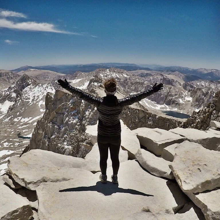
When most PCT thru-hikers take the alternate 17 mile route to Mount Whitney, they camp the night before at either the Crabtree Meadow Ranger Station or Guitar Lake and slack pack up to Whitney, bringing only water and snacks with them to the top and leave the rest of their belongings at camp. After hiking up to Whitney, they come back down, breakdown camp and head back to the PCT.
My trail family didn’t do that. Instead, we brought all of our stuff up with us to the junction of Whitney and the Whitney Portal. We left our packs at the junction, hiked up the 1.9 miles to Whitney and then came back to the junction to retrieve our packs. Then instead of going back down the way we came like most other PCT hikers, we went up, over and down the Whitney Portal towards Lone Pine.
Coming down the Whitney Portal was brutal. There was ice to cross over multiple times – I was the only one in the group who had microspikes. There were 99 switchbacks to navigate down. It was the longest 8 miles I’ve ever had to hike. Since we had such a long day, we didn’t take many breaks and hardly ate any food. Hiking up Whitney was hard enough, but coming down was even harder. I had two breakdowns – one when I reached the top of Whitney and one coming down the portal after I realized we still had another five miles to go.
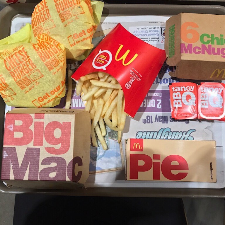
The silver lining in the day was knowing there was a McDonalds in Lone Pine we could have dinner at. Once I meal planned in my head what I’d eat when we got there, I was able to stop crying and focus on getting myself down those last five miles. Seriously, it was McDonalds that saved the day and got me off that mountain. Now whenever I think of Mount Whitney, the first thing that comes to mind is, “Never Again!”
Hard Day #2: Day 63 – Bear Ridge Trail to VVR (in the dark)
My second hardest day on trail was on my sixth day of being in the High Sierra all alone. I ended up hiking 25.8 miles on this day, making it the most physically challenging day in the Sierra section so far.
Mentally, it was hard because quite frankly, I was tired, dirty and lonely. I had spent the last week all by myself hiking up and down multiple passes, having to cross snowfields on most of them. I hadn’t had a shower in six days, ran out of clean clothes, had run out of DEET and was being eaten alive by mosquitoes, had to ford multiple creeks and rivers all by myself, was lonely from having to camp by myself each night and hadn’t had cell service so couldn’t let my friends and family know of my whereabouts. On top of it all, I knew I still had one more pass to make it over and one more big river to ford before heading off trail for a Zero Day.
Even though I had seen some of the most amazingly beautiful landscapes I’ve ever seen in my life, I was ready to get off trail for a day, talk to other people and eat food that didn’t require boiling water to cook.
Originally, I was going to hike to the ferry dock for Vermillion Valley Resort (VVR), take the ferry across the lake and then hitch five miles down the road to Mono Hot Springs where I would spend my Zero Day the next day. When I stopped for lunch that day, a group of hikers suggested I skip the ferry and take the Bear Ridge Trail down instead. They said it would only be a five mile hike into VVR and that if it got dark, they’d camp along the way and I was welcome to join them.
I hit the junction for the Bear Ridge Trail at around 7pm. The sun was starting to go down, but I decided to take my chances and keep going. I figured if it got too dark, I’d meet up with the other hikers and camp with them.
It got dark quickly, especially in the forested areas on the trail. I picked up my hiking pace, got my headlamp out, turned it on and made a deal with myself – I’d stop at the first tent I saw on trail and camp for the night.
As soon as I turned on my headlamp and started hiking again, I slipped on a rock, fell to my chest and snapped one of my trekking poles in half. I was sad about my trekking pole, but realized the trekking pole had stopped me from sliding face first into a tree. I got up, dusted myself off and kept going down the trail.
I never did see anyone camped along the trail as I hiked down. I don’t know what was more scary – hiking in the dark by myself or realizing I was the only person hiking the trail, in the dark! I made it down to the trailhead well after dark.
At the trailhead, I was still another 2.5 miles from VVR. Even though Mono Hot Springs was my ultimate destination for my Zero Day the next day, I wanted to get to VVR so I could camp that night with other people around and have plenty of time to get a hitch down to Mono Hot Springs in the morning.
Down the 2.5 mile road walk in the pitch dark black I went. I was so creeped out, I started playing music outloud on my phone, in hopes of scaring any animals away. I kept thinking something was behind me, but it was only the full moon shining on everything in its path.
After hiking over 25 miles for the day, at around 10:30, I walked into VVR. I was immediately greeted by a group of other hikers gathered around a campfire. They introduced themselves, showed me where the flushed toilets were, where I could set up my tent and let me know when and where breakfast would be in the morning. I was so relieved this day was finally over, I cried at the campfire in front of the other hikers. I was so exhausted, I didn’t even care. The tough day was now behind me.
Hard Day #3: Day 127 – Goat Rocks to White Pass Reroute
Goat Rocks was a section of the PCT I had been looking forward to doing. I’d seen countless pictures of other PCT hikers on this section and was excited to see the views with my own eyes.
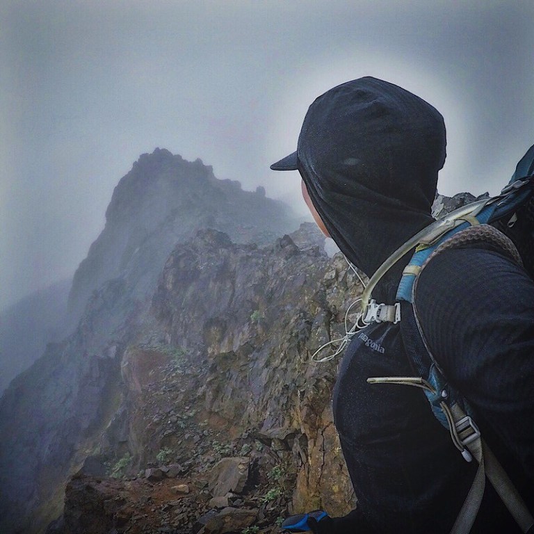
The day before doing the Goat Rocks section, it had been overcast and the clouds above looked like they might bring rain. Grit and I made a collective decision to camp down low in a forested area so we’d have some protection, just in case it rained. Our decision was a good one because it was cold and rained all night. In the morning, there was still plenty of fog, but the sun was peeping out in spots. We took our chances, packed up camp and headed up the mountain.
The higher I climbed, the colder the temperature got. I had all my clothing layers – fleece, raincoat, puffy, leggings and gloves on because it was so freakin cold. The fog also seemed to get thicker. It was as if I was hiking up into a cloud. I could barely see in front of me because the fog was so thick.
As I climbed closer to the top, I had two pretty decently sized snowfields to cross. Even though the fog was thick all around me, I could still manage to see the pretty steep drop off below me. One slip, one fall and it would be a slick and steep ride down.
After the snowfields, I had to make a decision – stay on the PCT (the stock route) or take the Old Snowy route where I’d have to scramble my way to the top to see the epic views along the knife edge portion of the mountain. Since I was surrounded by fog, I stayed on the PCT. Turns out the PCT was quite challenging. The rocks were slick and it was still a long way down if I were to slip.
I’m not afraid of heights, but hiking Goat Rocks made me feel like I was. Sometimes the fog would open up just to let enough sunlight in and show me how high I was and how steep of a drop it was on the way down. This entire section of the trail was covered in loose rocks and had numerous steep ups and steep downs. It was incredibly cold and windy up there. I had to keep moving in order to keep my body temperature up and the shivers at bay. Half way through this section, about two miles in, I was ready for my hiking for the day to be over.
At the bottom of Goat Rocks, the PCT was closed due to multiple wildfires in the area. We were then rerouted on another series of trails coming down from Goat Rocks and into White Pass. Since it was a reroute on multiple trails, no one seemed to know exactly how long the reroute was or what the elevation gain/loss might be. A couple SoBos had told us the night before that the reroute would mainly be all down for us heading north. They were wrong. Very wrong.
For the first mile, the reroute did head down. After we passed the first campsite on the trail, we started to climb. The first climb was steep and long. Parts of the trail were crumbly with loose rock and most of this section was exposed in the hot sun. Once I made my way to the top, caught my breath and said a few choice words, I could see the two wildfires burning nearby. I could also see back to Goat Rocks. The fog had lifted completely. It was now clear blue, sunny skies over the entire section. I was so bummed. I’d been robbed of the views I’d been looking forward to seeing. I had to keep moving north if I wanted to get into town that night.
The best part of the reroute were the views. Now that the fog and clouds had burned off, I could see multiple lakes below and Mount Rainier off in the distance. Those beautiful views came with a tough and steep price. All along the reroute, the trail had numerous climbs up and steep hikes down. It never flattened out for very long. The trail itself was thin, filled with loose rock, crumbly and even overgrown with bushes and plants in some places. It was a difficult trail to travel on and forced me to slowdown my hiking pace.
A couple hours into the reroute, I became hellbent on making it into town that evening. I was tired, dirty, thirsty and hungry. I didn’t want to spend another night on trail, especially this hellacious reroute. So I kicked it in high gear and went as fast as I could, not stopping for breaks or to filter/refill my water. Since I had no idea how long the reroute was to town, it felt like the trail was never going to end. I’d climb up to the top of something and then down the other side, through several densely forested areas, having to climb up and down and up again.
At one point, I could start to hear a nearby highway. I got excited because I knew I must have been getting close to the end. At this time, it was also starting to get dark out. Soon I’d have to get my headlamp out to see and if I got to the highway too late, no one would stop to pick me up and give me a ride into town.
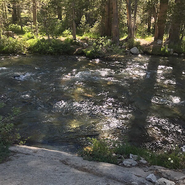
I saw a forest boundary line, getting even more excited about how close I must be getting to the end until I saw the fast moving creek right after the sign. My heart sank. It was like the Universe was testing me to see how bad I wanted to go into town that evening. There was no bridge going over the creek. It was starting to get pretty dark and the wind had picked up. There was a sketchy log that went halfway across the creek, but I didn’t feel comfortable enough crossing over the log and jumping off to the other side with my pack on. Desperate to get into town, I sat down on the rocks, took my shoes off, pulled my leggings up to my knees and walked my ass across the creek. Since it was getting dark, it was hard to see just how deep the creek was where I was crossing it. Halfway across, I fell into the creek up to my thighs, getting my leggings soaked in the cold water.
As soon I got across to the other side and out of the water, I didn’t have time to wipe my feet off. I stuffed my wet feet into my dry socks and shoes and moved my soaked leggings all the way down my legs. I got my headlamp out and scrambled my way on down the trail towards the highway. Only the trail didn’t go down. It was a steep half-mile climb up towards the road.
By the time I got to the highway, I was shivering, out of breath and the sun had set, making it dark out. I watched as the occasional car sped up and down the mountain highway. It would be a three mile road walk up into town. There wasn’t a big enough shoulder to walk along the highway safely in the dark. The chances of someone seeing me hitching on the highway or picking me up for that matter were slim to none. Feeling defeated, I could feel the tears form in my eyes as I slowly walked back down the trail.
My only option at this point was to pitch my tent somewhere along the trail so I could get back up to the highway first thing in the morning and hopefully get a hitch into town. Since the trail was such a steep incline, there wasn’t a flat spot to camp at close to the highway. The flattest spot available would be literally right on trail.
As I started to take my tent out of my pack, I saw a set of headlights from the highway. A car had pulled over to the side of the road! Desperate, I left my pack and tent and ran up to the highway with my headlamp still on. When I reached the highway, I saw the car on the side of the road, but was too scared to approach it. Instead, I turned my back to the car and pretended to read the fire closure notices at the trailhead.
“Are you hiking the PCT?” asked the male voice coming from the car. I smiled, turned around and screamed, “Yes!”
“Do you want a ride into town?”
“I’d LOVE a ride! Let me go grab my stuff.”
I ran down the trail, stuffed my tent back into my pack, threw my pack on my back and ran towards the car. In normal situations, I’d be more cautious by getting a good look at the driver before hopping in for a hitch, but I figured nothing could be worse than having to sleep on a slope, in the middle of the trail, in my tent, on a cold night with wet leggings. Town was only three miles away!
Luckily for me, the hitch turned out to be harmless. He was getting ready to start his section hike from White Pass to Trout Lake – and he was from Seattle. What are the odds?
As we drove up the highway, I gave him detailed scoop about the reroute, in-between thanking him repeatedly for giving me a ride into town.
He dropped me off at the Kracker Barrel, the town’s local convenience store/gas station where I thanked him one more time and said goodbye. Kracker Barrel was closed for the evening so I walked behind the building, ready to set up my tent at the first safe place I could find. As I looked at the back of the building, to my right I could see the lit up sign on the building next door that said, “Lodging” After the day I had, I would have paid anything for a room for the night.
I immediately walked next door and rented a room for the evening. In this magical and well-earned room, I would take a warm shower, soak my feet in Epsom salt, heat up one of my hiker trash meals in the room’s microwave and eat candy in a warm, clean bed while I watched “Purple Rain” on TV until 2:30 in the morning. A perfect ending to an incredibly tough day.
I love what you are doing here! I adore backpacking I don’t have a lot of people to go with that’s the whole problem. But I love it I’ve done upper Lena Lake which was a challenge. I just got back from the Rocks wilderness. We did part of the PCT over Nanny ridge. We camped cispus pass, below old snowy and above goat lake on Hawkeye ridge! I can’t get enough of backpacking it’s amazing I love watching your videos and expert advice! ❤️
I love this! Cispus Pass was the first section on the PCT in Washington where I really stopped and said, “Whoah!” Everyone had kept telling me Washington was like another Sierra in terms of beauty, but I wasn’t seeing. That is, not until I saw Cusps Pass. Then from there, the PCT just kept getting better and better and more beautiful. I can’t wait to come back to this area!
Great story! Now I know why, Whitney never again. Thanks for the response back. Aloha
You’re very welcome!